- Project title
Digital Trails
- Group name
Trailblazers
- Sheridan program name
Honours Bachelor of Computer Science (Mobile Computing)
- Release Date
12/08/2020
- Project Description
The Oakville Heritage Trails are a great resource for education, transportation and well-being, but not all residents are utilizing them to their full potential. Some barriers exist in the areas of accessibility and engagement that hinder the experience of being on the Heritage Trails. Many residents do not even know the trails exist, or have taken the time to visit them.
The Digital Trails mobile app helps residents plan out trips that meet their personal needs, educate them on the history of the trails and the Town, and provides residents with an engaging and fun experience on the trails. The software accomplishes this by utilizing live navigation, shared user experiences, interactive stories and augmented reality. The Oakville Community Foundation utilizes the Digital Trails website to educate and engage residents with interesting and accessible information on the history of Oakville and the surrounding areas. The Digital trails system as a whole fosters connections between residents, community members and local government centered around the use of the Oakville Heritage Trails.
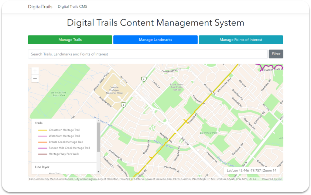
The Digital Trails app and web app utilizes Esri's suite of Geoinformation system technologies to present trail data and other information on maps. The app uses Apple's ARKit to deliver an engaging experience. The app also uses the IBM's Watson Assistant to develop the app's virtual assistant. Other technologies include, ASP.NET Core, IBM Cloud Foundry. The app currently delivers trip planning features like trail maps, trail accessibility information, live navigation, point of interest sharing, trail utility information as well as an engaging learning AR experience, and an experience featuring a virtual assistant.
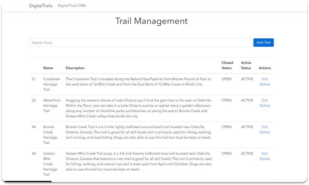
The Digital Trails website currently delivers mapping and content administration features. Future plans include community building features like trail events creation, user profiles and a unique directions system as well as other exciting features.
- Project background/history
The Digital Trails' core idea is the brain child of the Town of Oakville and the Oakville Community Foundation. They sort a solution that uses the trails in Oakville to increase residents sense of belonging. The Capstone team then brainstormed possible use-cases and built out what would become the Digital Trails system.
- Project features
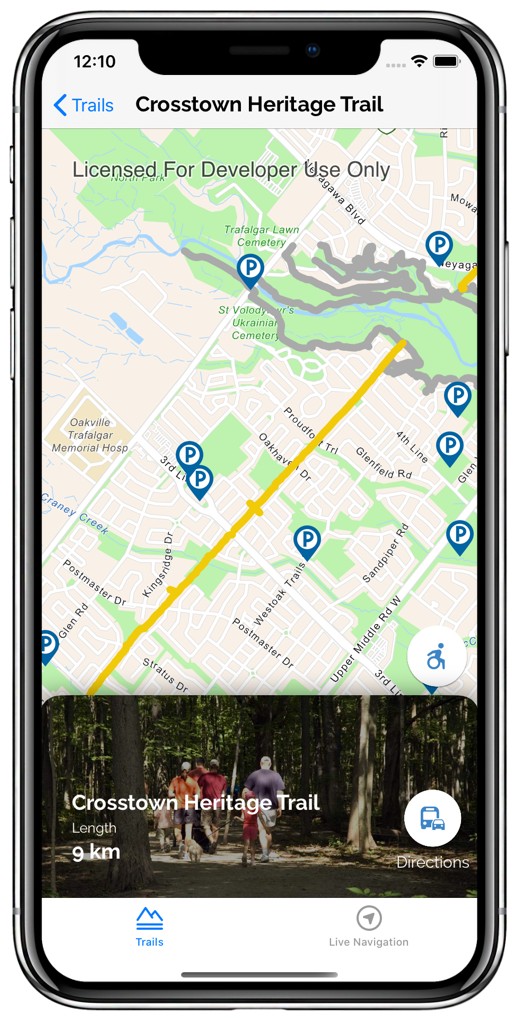
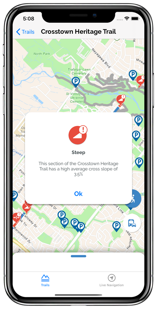
- View what sections of a trail are accessible or inaccessible and why
- Seeing the location of parking lots and other utilities near a Trail
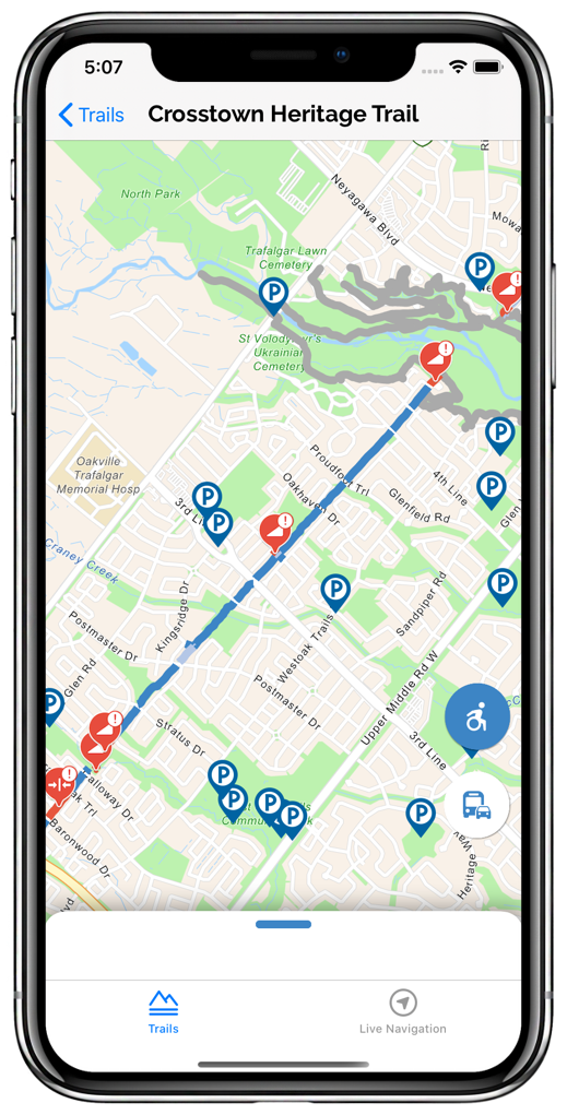
- Live navigation while on a trail
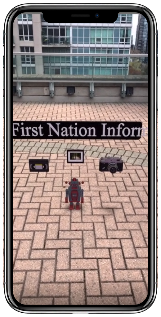
- Learning about the history of Oakville through an engaging AR expeirnce
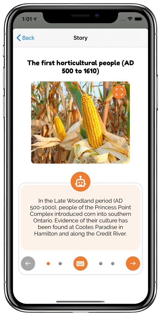
- Learning about the history of Oakville from an interactive story session with a virtual assistant
- Create and visit points of interesting on trails or any part of Oakville
- Roburst Intergration with Town of Oakville geoinformation data, delivering update mapping information
- Trail and trail experience content management
-
Videos
- Additional information
The team is made up of Kenneth Uyabeme, Cory Da Silva and Mike Banks, three well-rounded, dedicated students in their fourth year of study in the Honor’s Bachelor of Computer Science (Mobile Computing) program.
-
Student NameStudent role in group
Cory Da Silva
Lead Software Architect/Lead Risk Analyst
Kenneth Uyabeme
Project Owner/ User Experience Design Lead
Mike Banks
Scrum Master, Lead Requirement Analyst
- Image Gallery
-
Follow us